THE BIKE LEG
THE SNOW ROAD
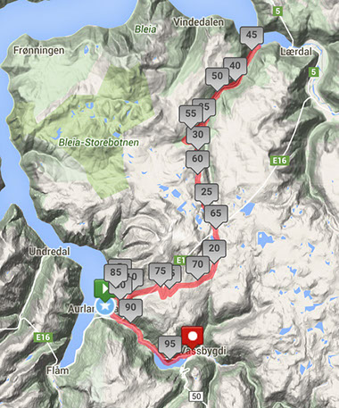
The 98 km bike leg is extremely hard with a total elevation of more than 3200 meters. Starting in village of Aurland, you immediately start the steep climb towards the top at 1320 meters above sea level. Then, after the steep drop down to the fjord at the village of Erdal, you turn around, and must once again tackle the steep and long hills back to Aurland. This famous and narrow mountain route offers unparalleled views of some of the most spectacular fjord landscapes in the world. T2 is at the end of Vassbygdvatnet. Drafting will be permitted during the climbs - which basically means most of the time! Time trial (triathlon) bikes is permitted, although perhaps not recommended for this event... We will have a drink/food station at the highest point of the mountain. Make sure to bring warm and wind/rain-resistant clothes, as the conditions on the bike leg can get quite harsh!
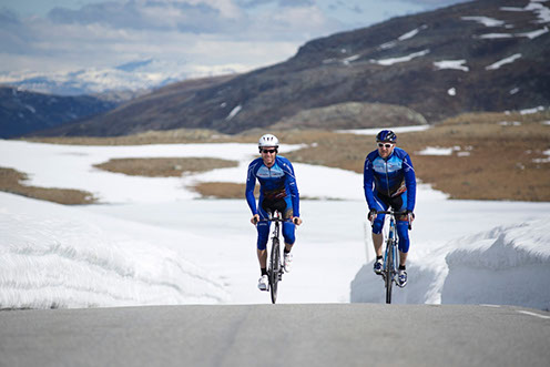
The AXTRI Crew out testing the course on the mountain plateau, aptly named "the Snow Road"...
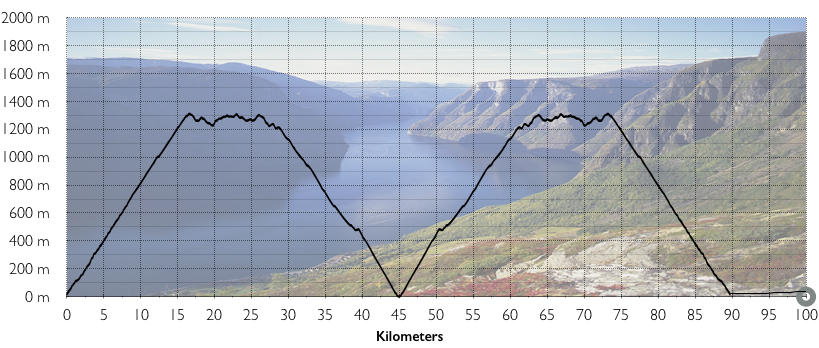
ELEVATION CHART
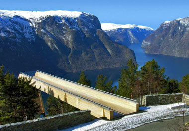
The famous lookout at Stegastein - around half-way up the mountain (600 meters above sea level).
Elevatio chart of the bike leg.